
 While no one is known to have lived in Chesterfield in the dangerous early decades, soldiers and explorers certainly knew and walked this land.
As noted earlier, Chesterfield (“Township #1”) was created in 1736 along with 3 other Connecticut River towns.
This happened just after Winchester, Keene and Swanzey were created in 1733-1734 in the valley of the Ashuelot River. These towns were first known as Arlington, and Upper and Lower Ashuelot. Chesterfield’s rockier landscape was less appealing to the first settlers of Cheshire County.
But these three Massachusetts land grants established the first boundaries of Chesterfield – the south and east lines of our town.
 Old Winchester (then called Arlington) had an inverted “L” shape which gave it both frontage on the Connecticut River and prime land in the Ashuelot River valley. It stretched all the way to the Connecticut and included the northern part of Hinsdale across from Brattleboro. The north line of 1733 Arlington is the same as today’s Chesterfield south line.
==================================================================================================================
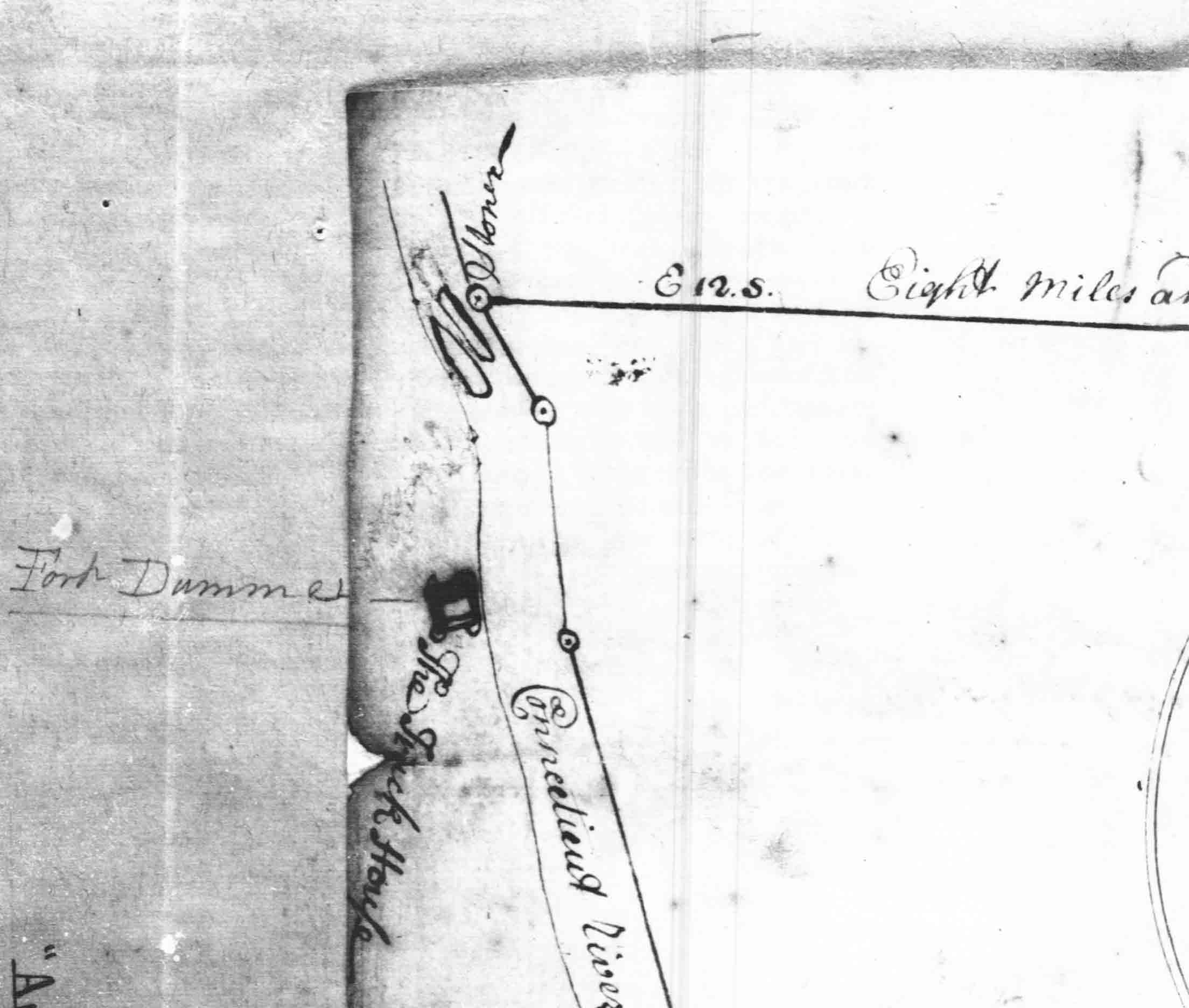 Chesterfield’s southwest corner is shown in this section from the Arlington map.
The surveyors who mapped Arlington and the two Ashuelot townships in 1733-4 were likely the first Europeans to explore Chesterfield’s back lands.
Fort Dummer is shown on this map as “Truck House”, a colonial expression for a trading post.
Fort Dummer was a center of commercial activity as well as a fort. Trading parties passed along the Connecticut River frequently in the 1730s and 1740s.
===============================================================================================
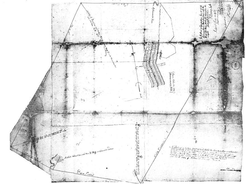 This is the 1734 map of Lower Ashuelot, Swanzey today. This map established Chesterfield’s eastern boundary line.
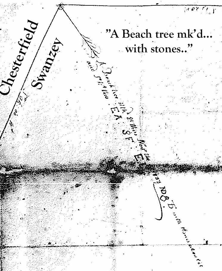
Although this map was drawn in 1734, the pile of stones at the north end of the line was set a year earlier, when Keene (Upper Ashuelot) was surveyed. See below.
==============================================================================================
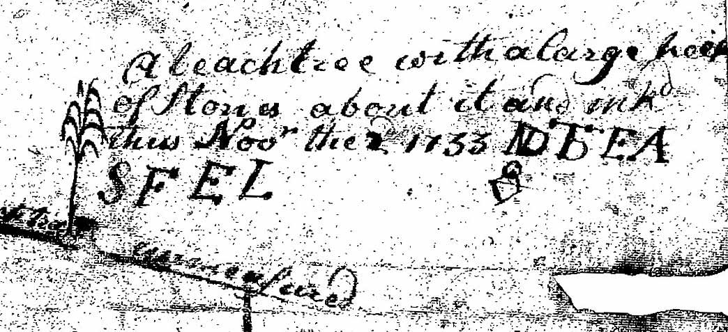 “A beach tree with a large heap of stones” marked the north end of the Swanzey – Chesterfield line in 1733. This map excerpt from the old Keene map reports the day, November 2, 1733, that four surveyors carved their initials into the beech tree.
This section of the Keene map is upside down – the whole map is seen below.
==================================================================================================
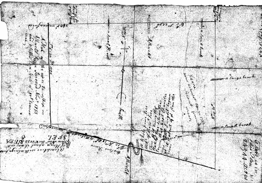 The excerpt above comes from this map of Keene.
The southwest corner of Keene will become the northeast corner of Chesterfield. Note that the actual Keene corner was not marked. The beech tree marked is on Keene’s south line at the spot where the Swanzey line meet Keene.
It is interesting that neither of Keenes’s west corners were marked on the ground by the surveyors.
Note on the northern boundary of this map that there is an intermediate point marked on that line (the tree symbol and words “Stake and heap of stones”).
This point appears to be southeast corner of a new town soon to be established. The surveyors seem to have already known about Township #2 (Westmoreland) which was to be formally created three years later. It is not certain, however, that this pile of stones is Westmoreland’s forthcoming corner, as the next map illustrates. More study needed here.
=================================================================================================
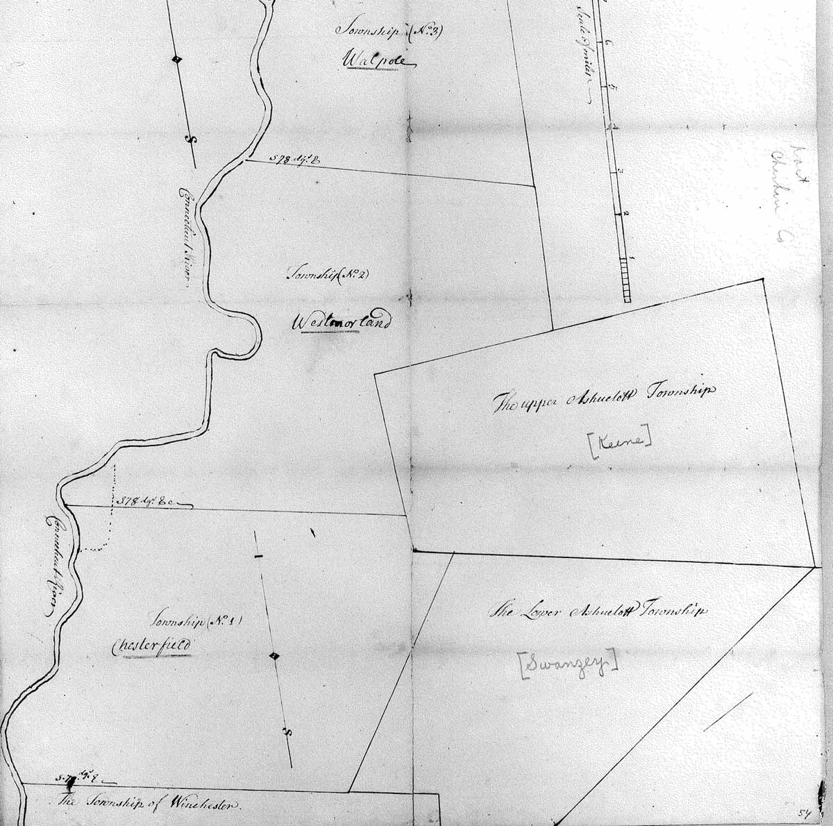 This colonial era map is undated, but it was probably drawn circa 1750. The original is at the state archives in Concord.
This seems to show the shapes of five Massachusetts towns before New Hampshire took over this area. Note that “Township No. 1” etc are written in different handwriting than the modern town names.
Note the dashed outline straddling the Westmoreland-Chesterfield line along the river. This is probably the “Govern0r’s Farm”, a large grant of land which was reserved for New Hampshire Governor Benning Wentworth.