
Here are a series of old town maps showing remarkable details of roads and houses.
 1858
1858
In 1858 the first complete road map of the town appeared. This map, and its companion detail maps of Chesterfield Center and Chesterfield Factory (Spofford), come from the the Map of Cheshire County by L. Fagan, a large wall map.
Most of the roads are shown, but more importantly, the maps show every home, school, church, cemetery and business and the names of the owners.
The maps have proved to be a very accurate picture of Chesterfield in 1858. Many geographic placenames appear for the first time on a map, such as Governor’s Brook and Pistareen Mountain. Both the upper (Davis) and lower (Norcross) ferries are identified by name. The mountain we call Wantastiquet is called Mine Mountain.
The population of Chesterfield was 1434 in 1860.
==============================================================================================
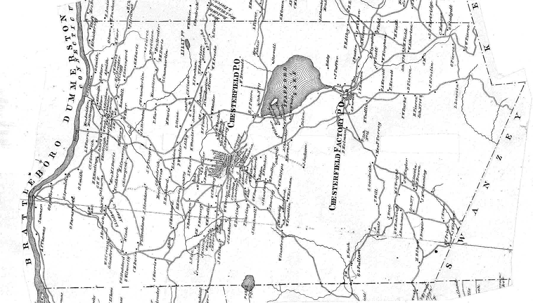
1877
This map is part of the “Atlas of Cheshire County” by C. H. Rockwood.
Cheshire County was one of only two counties in New Hampshire that was mapped in the 1880’s, so we are fortunate to have this record Although awkward to use because it is not north-oriented like the other maps, this map shows many new names and, for the first time, two of the villages are designated as post office sites.
The population of Chesterfield was ____in 1880
==============================================================================================
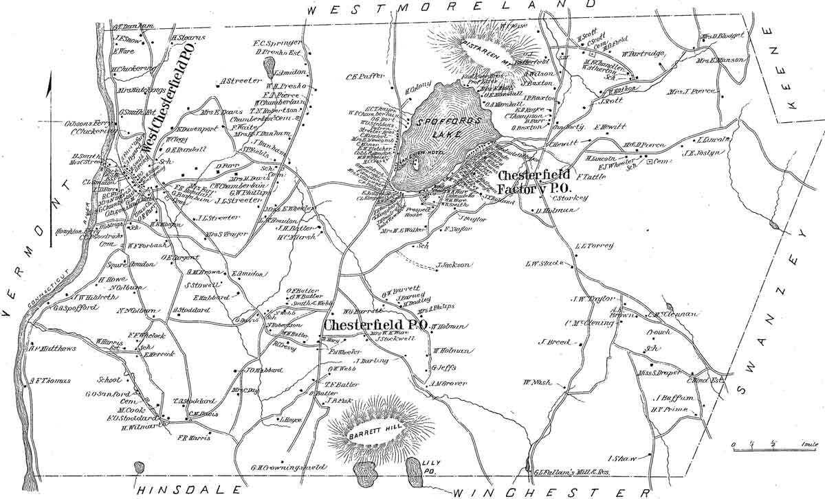
1892
The D H Hurd Atlas New Hampshire is the source of this map and two village detail maps. Among the changes: West Chesterfield Village is now designated a post office.
For the first time, we see development around the lake, which is now called Spofford Lake. The Prospect House and Woodside Cottages are the beginning of an important tourist industry. Although indicated on the map, the Lakeview Hotel was never built. There may have been two cottages on the island, however.
Citizen’s Hall, in West Chesterfield, and Village Hall in Chesterfield Factory have been built. The two ferries across the Connecticut are shown, but not the Suspension Bridge or the road leading to it. The bridge was completed in 18xx The population of Chesterfield was in 1890.
==============================================================================================
 1906
1906
Our last town-wide map dates in 1906. This is an interesting map – it is of the same style as the 19th century land ownership maps , but it is not complete.
It shows most roads, and many homes, but not all of them. This map is an excerpt from a small wall map of Cheshire County made by Chauncey Newell of Alstead, New Hampshire. We are grateful to Mr. Newell for producing a home-ownership map, but wish he had made it complete – a number of houses which were in Chestefield are not shown, notably in the densely populated villages.
Some placements are neither accurate nor spelled correctly.
=============================================================================================