
Nine separate fire insurance maps showing the Brooks House and Main Street from 1885-1964. These very detailed maps showing building materials and use were made so that fire insurance companies in far off cities could assess the fire risk without actually coming to Brattleboro. Other Brooks House Maps
======================================================================================================================================
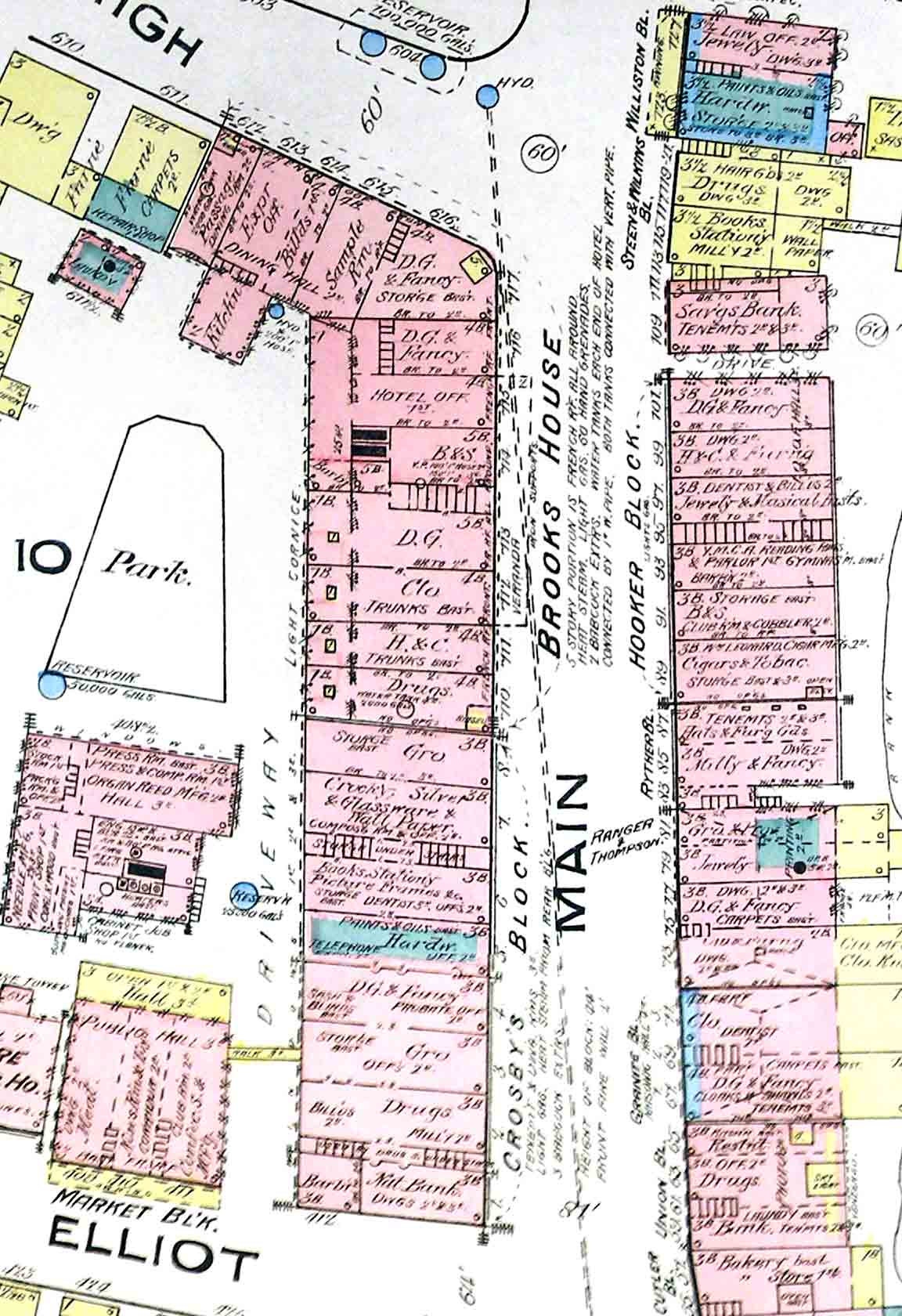
1885
1885
======================================================================================================================================
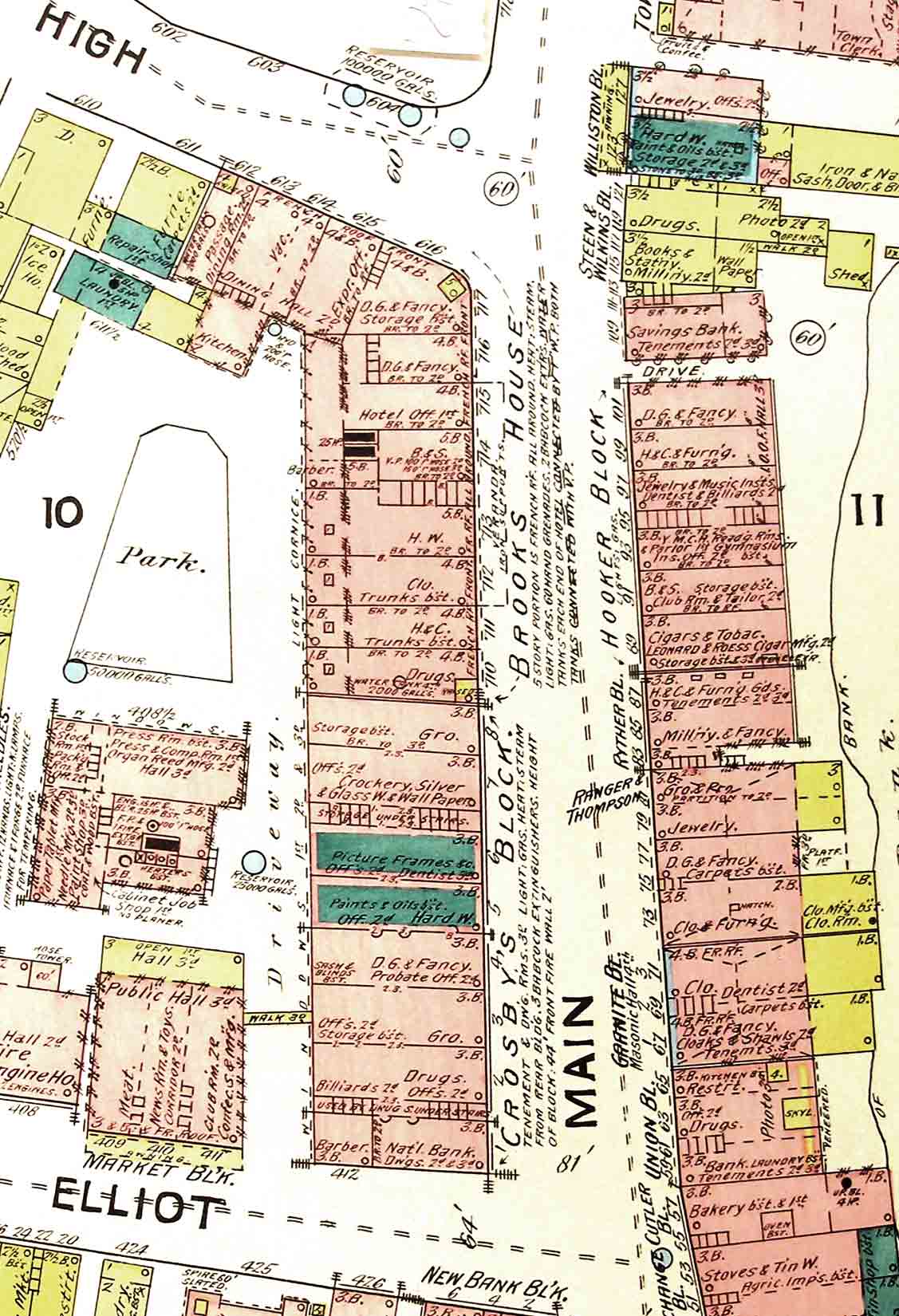
1891
======================================================================================================================================
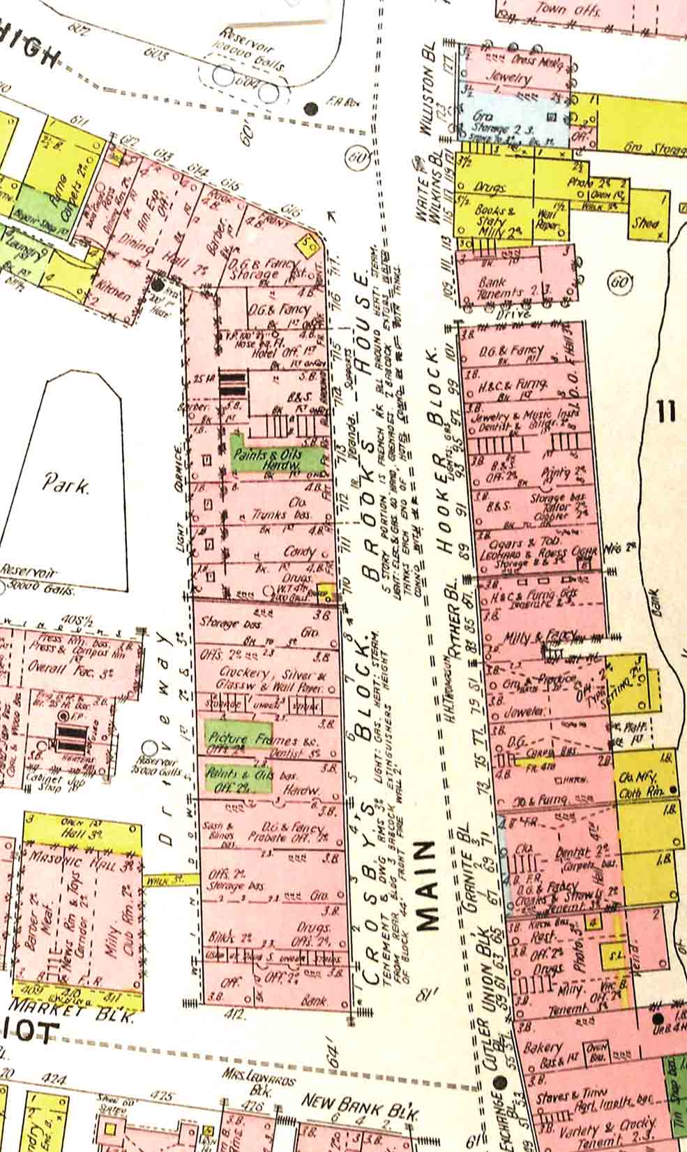
1896
======================================================================================================================================
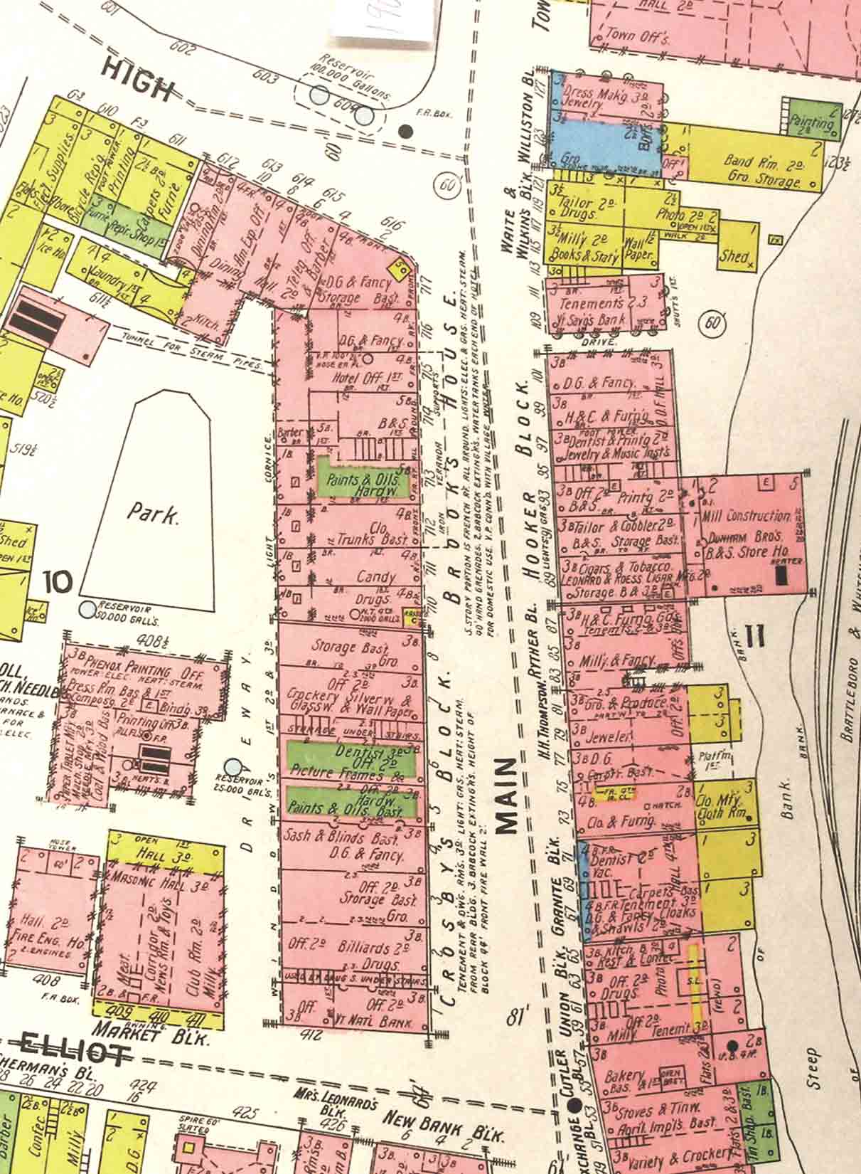 1901
1901
======================================================================================================================================
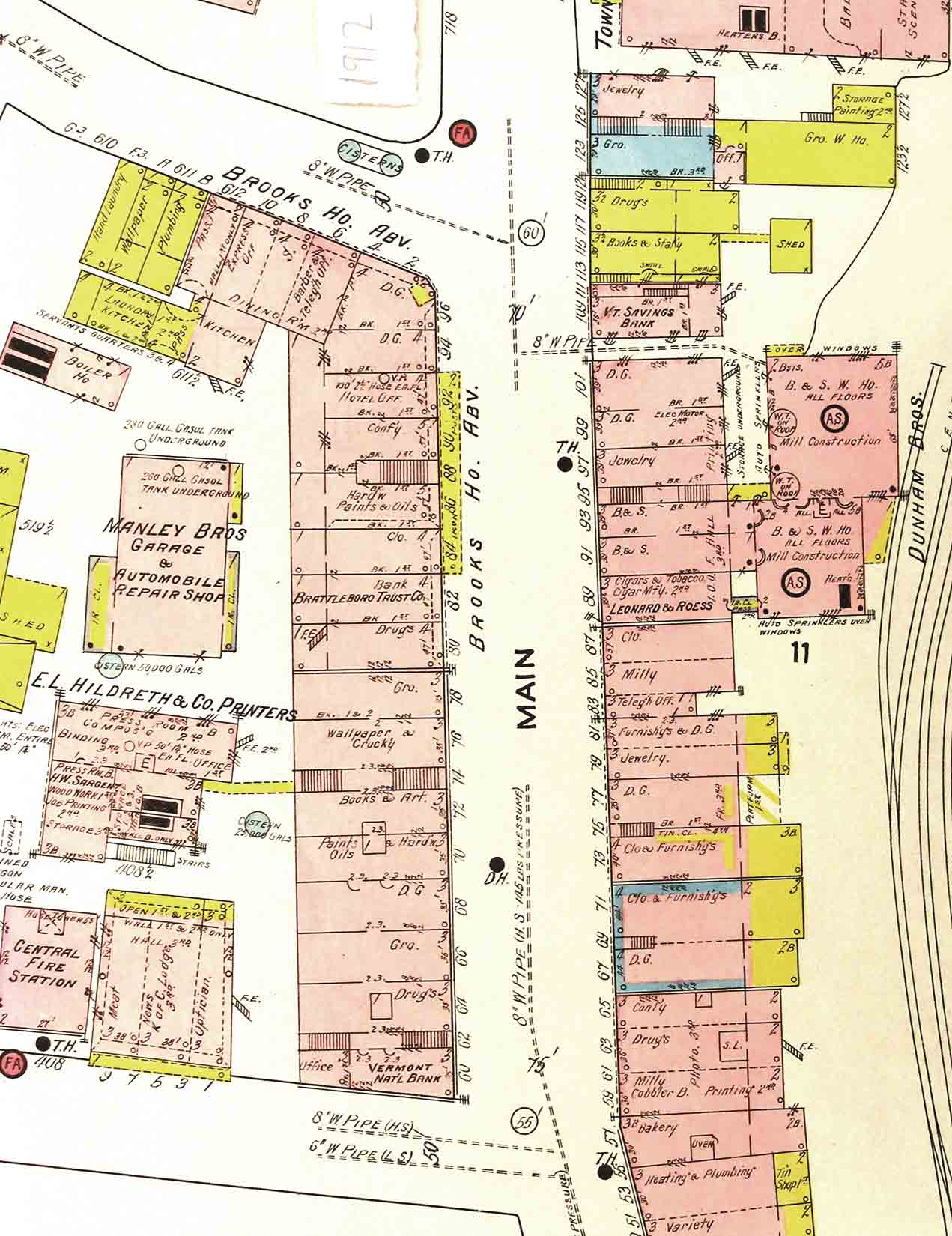 1912
1912
======================================================================================================================================
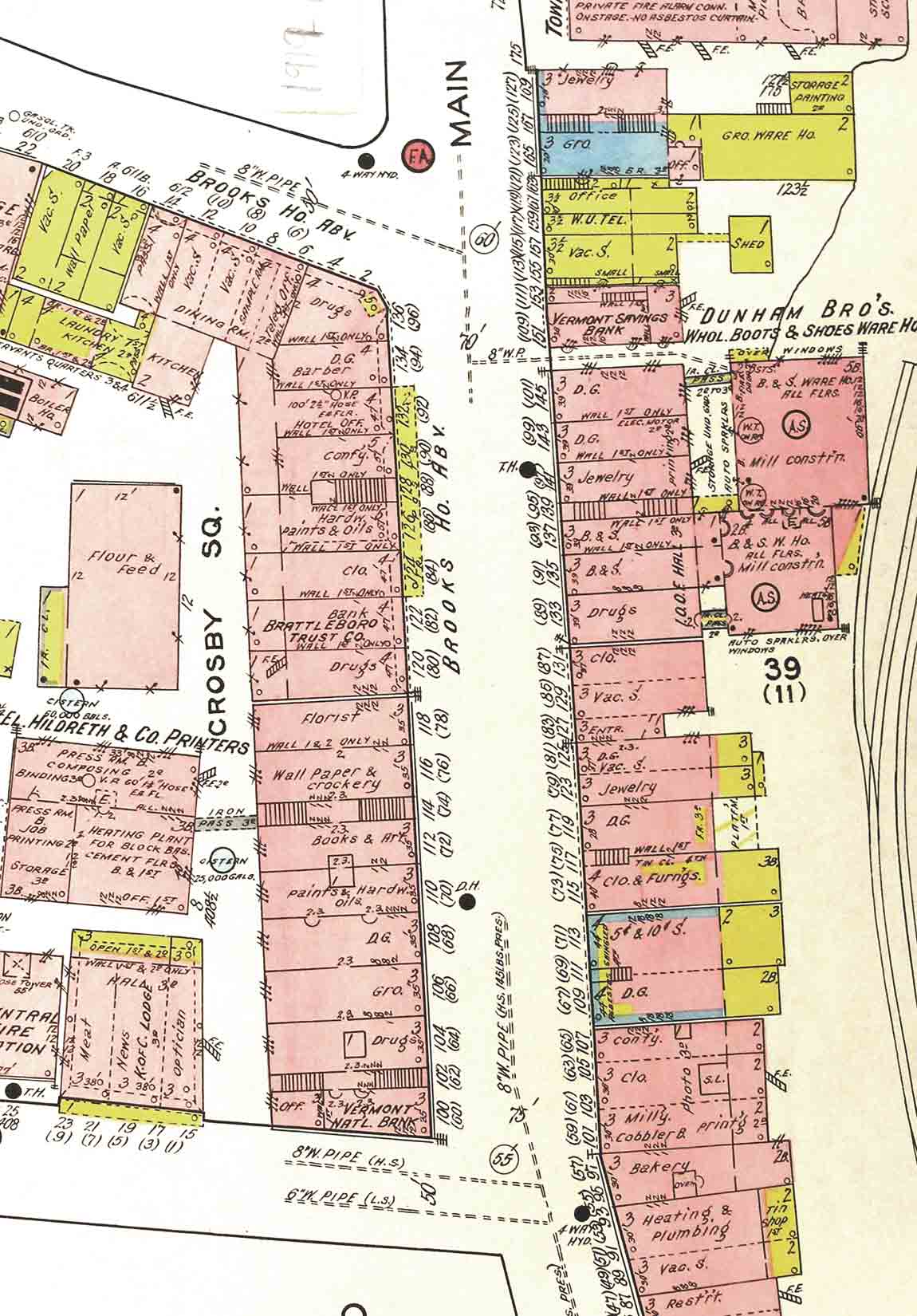
1919
======================================================================================================================================
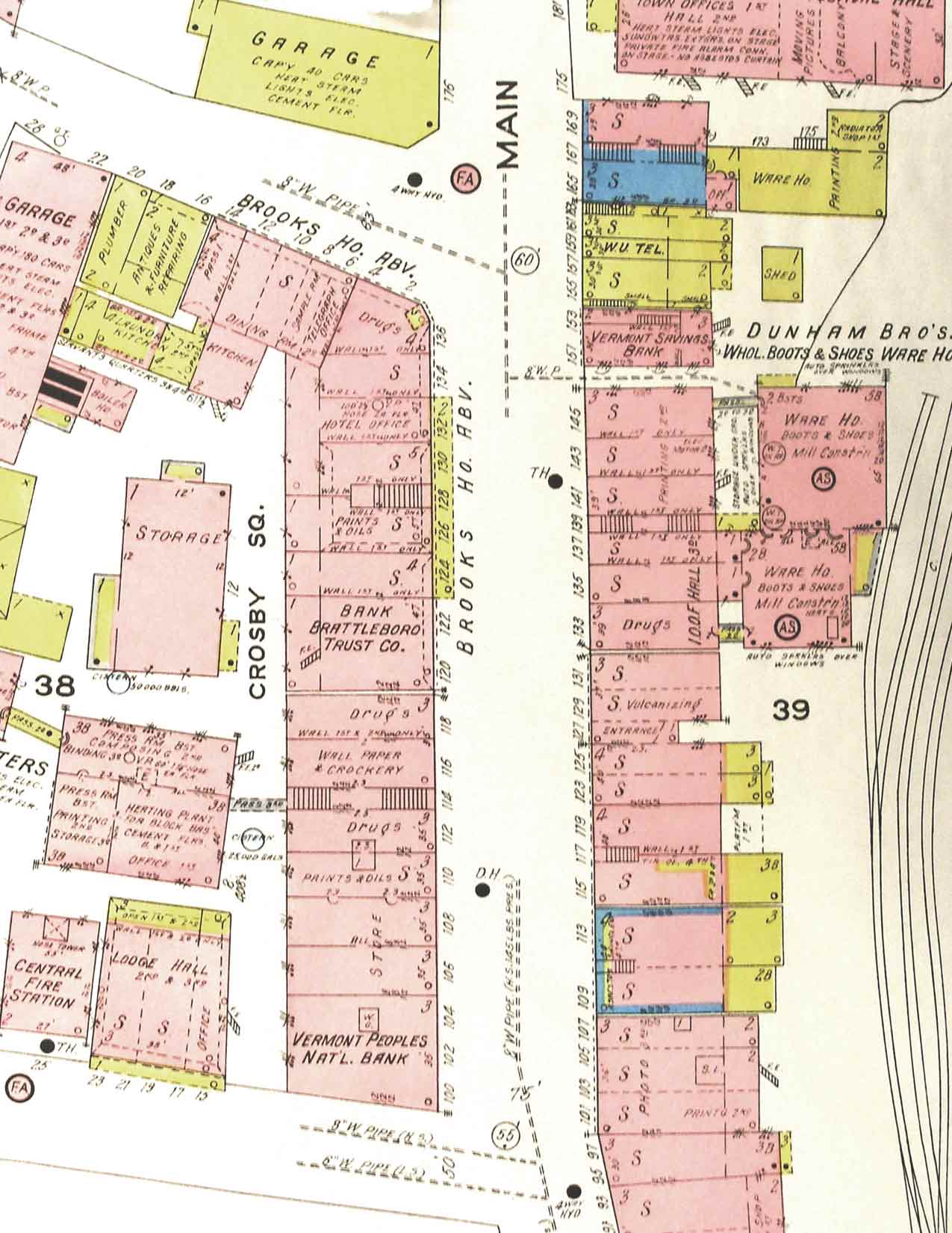 1925
1925
======================================================================================================================================
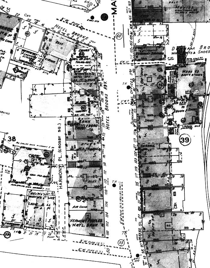 1945 – 1925
======================================================================================================================================
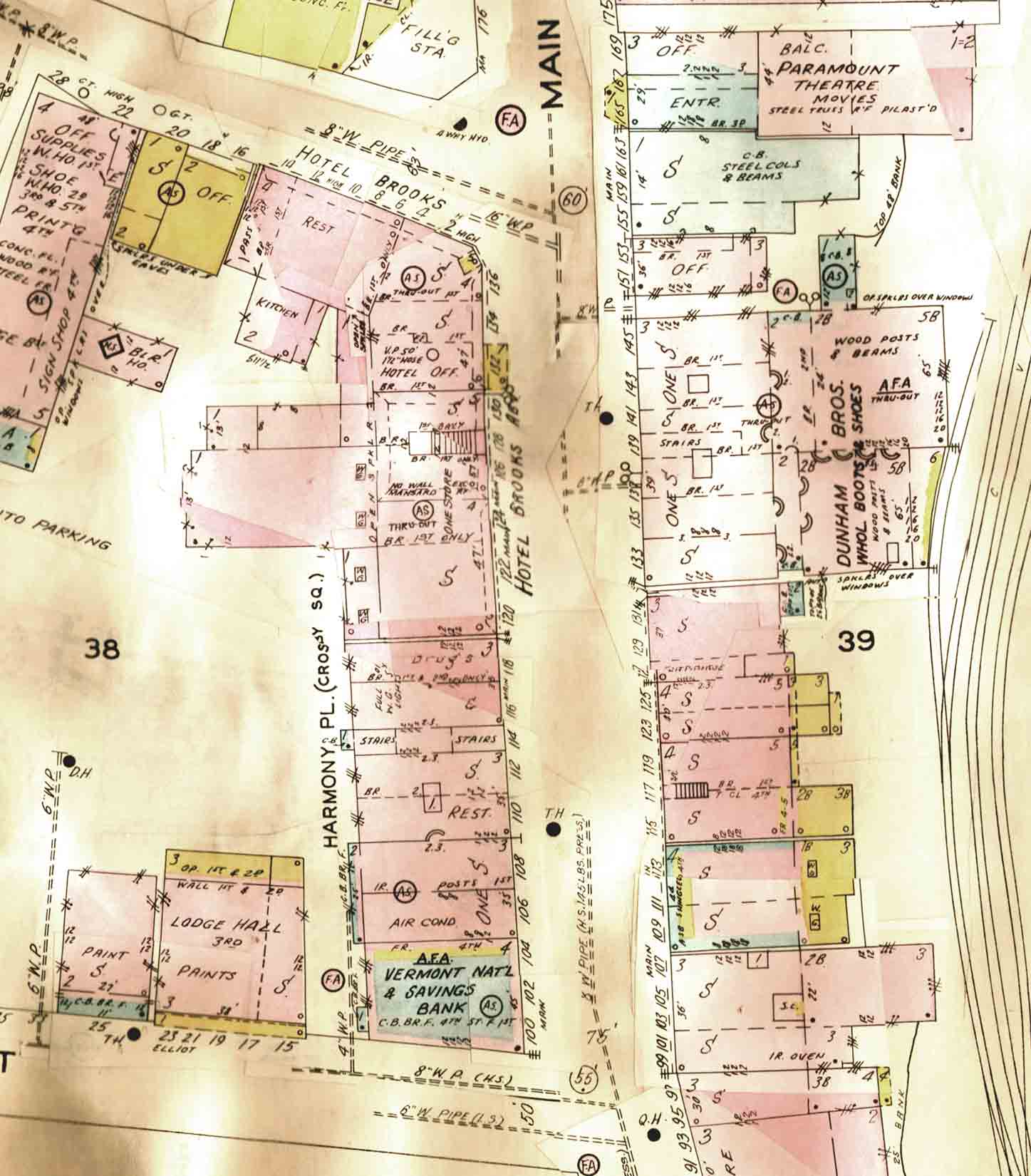 1964 (1925)
======================================================================================================================================